
A FIELD GUIDE FOR YOUR EVENT, BUILT WITH YOU.
You already have the maps, the schedule and the spectator information. We turn them into one mobile event field guide, review it with you, and publish it under one link and one QR code.
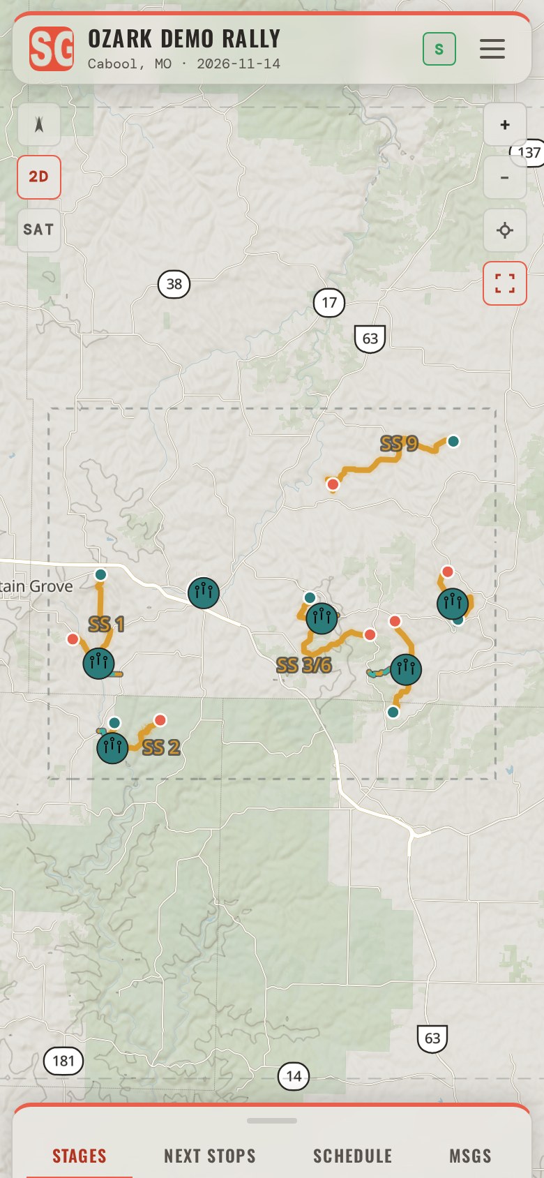
One field guide for your spectators, and the work of building it.
- The guideA mobile event field guide opened from a link or QR code, with no account and nothing to install. Spectators pass it on from its Share screen: the link, or the QR code to scan off the phone.
- The mapStages or courses, spectator areas, parking, access, start, finish, service and the other event locations, on the terrain, as map or satellite.
- DirectionsTurn-by-turn from wherever the spectator is to each area, around the roads the event closes, with the turns spoken and a driving mode.
- BasecampEach spectator saves where they are staying and gets directions back to it from anywhere in the saved area.
- Offline useThe event saves itself to the phone on the first open, so the map and the directions keep working where service drops.
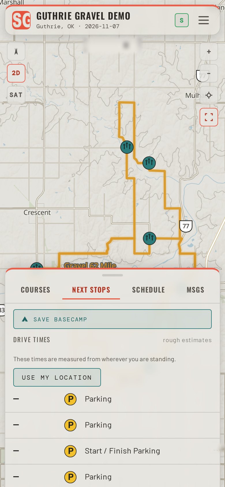
- Schedule and noticesThe schedule per day with the drive time to what is next, road status per stage, and your notices to every phone that has the guide.
- The buildWe import your files, map the event, place what the files left out, and check it with you before it goes live.
The event information you already have.
-
Maps
Provide the stage or course routes, pins and other points of interest, and the event areas, as KMZ or KML files. We take this information and develop your custom field guide. Need a starting point for organizing your event file? Use our event building file in Google Earth.
-
Schedule
Stage Guides incorporates your schedule to help spectators know where to go next, with the drive time to each area from where they are. An error on the posted schedule, or a last-minute change? Update it in the portal and every open guide with signal picks it up within half a minute and shows a NEW banner.
-
Spectator information
Build the spectator information into your KMZ or KML file to develop a robust field guide for your spectators. Stage Guides can create designated transit routes for the navigation engine, and identify event zones like Parc Exposé, Service and Awards in addition to the spectator zones on course. Detailed information can include parking areas with instructions, course viewing areas, restricted and VIP areas, event amenities, and more.
-
Sponsors
Sponsors are a key piece of an event's success, and the guide gives them visibility on five surfaces every spectator is holding. Send names, logos, links and tiers; the sponsor workbook carries all of it.
Most organizers have all of this before they call. We work from your files as they are; the templates are the portal's own copies, with the authoring guide beside them.
Five steps.
- 1Talk about the event.
- 2Share the maps, schedule and event information you already have.
- 3Stage Guides builds the guide.
- 4Review it together and confirm the information.
- 5Stage Guides publishes the guide and provides the event link and QR code.
Stage Guides handles the software and the guide setup. You provide the event information and review the finished guide.
- Event daySupport on event day is agreed per event, by phone or in person.
- Changes during the eventRoad status, an alert and notices are set from one screen on event day, by you or by us, and reach every phone the next time it has service.
- PricingPer event, agreed on the call, based on the event's size and days.
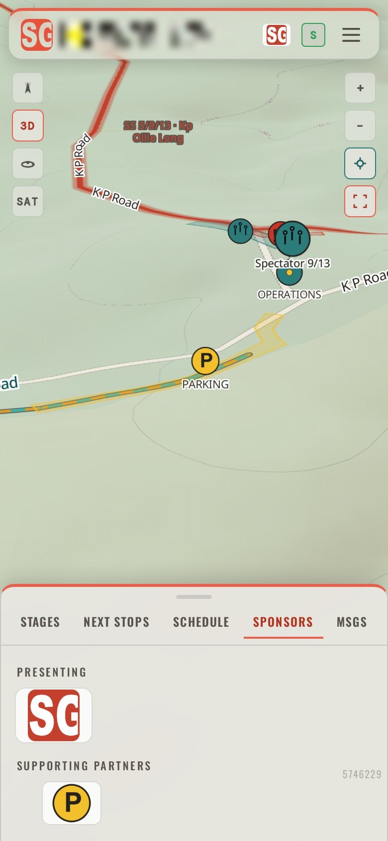
Sponsors in the guide, and a report afterwards.
Sponsor logos can appear in the event header, on the schedule banner, on the Sponsors tab, on a stage and on a place: five surfaces, every one in the guide the spectator is holding. After the event you receive a report, one page per sponsor, with how many times each was seen and how many times it was tapped, kept apart, as PDF and CSV, to support your sponsorship renewals.
Does the spectator need an account, or an app from a store?
No. The guide opens in the phone's browser from your link or QR code. There is nothing to sign up for and nothing to install, and it can be added to the home screen like an app.
Does the guide work without cellular service?
The event saves itself to the phone on the first open with signal. The saved map and the directions keep working where cellular service is unavailable, within the saved coverage area. Satellite imagery, the 3D view and new notices from the organizer need a connection.
What happens when something changes on the day?
Road status per stage, an alert that stays at the top of every screen until it is cleared, and notices are set from one screen on event day, and every phone picks them up the next time it has service.
Is Stage Guides a timing, results or safety system?
No. Marshals and tape run the stage, and timing and results stay with the people who keep them. The guide carries what you decide to tell spectators and gets them where you want them.
Who does the work?
We do. You share the event information and review the guide. We import the files, build the map and the schedule, place what the files left out, and publish when you confirm it.
How do we start?
Through the contact page. If you can send the course file and the schedule ahead, we bring a first version of your guide to the call.